Eruption Effects

Contact Us 
 Addicted to Bardabunga on Facebook
Welcome to the Bárðarbunga FAQ

Please click on the question links to the left to view the answers

This FAQ is updated frequently, but common sense is important! Things can change rapidly, and local authorities such as IMO and your airline are the best source of up-to-the-minute information

Facebook thumbnail image © University of Iceland/Ármann Höskuldsson, page background image © University of Iceland/Guðrún Sverrisdóttir. Images used with permission

Is there going to be a lot of ash?

That depends. Currently, the eruption is taking place on fissures to the northeast of the volcano itself. These fissures are not under the glacier, so they aren't producing a significant amount of ash.

If the fissures expand to underneath the glacier, ash will be produced. If Bárðarbunga itself erupts, there will definitely be ash. Until those things happen, though (if they happen at all), there won't be a large quantity of ash.

I go on vacation in (insert number here) days. Should I change my flight?

Probably not.

First, as mentioned, the eruption is not currently producing a large amount of ash.  It's also important to understand that aviation rules have changed since the disastrous eruption of Eyjafjallajökull in 2010, so even if there is significant ash from an eruption, it is likely that far fewer flights will be affected.

But... I just saw that scientists are gravely concerned!

They are gravely concerned, and rightfully so. A jökulhlaup in some locations could cause a lot of problems above and beyond getting people out of harm's way--it could affect some of Iceland's hydropower plants. The loss of one or more power plants would be a serious problem, especially with winter coming on.

Iceland scientists are doing the sensible thing. They are looking at worst-case scenarios and working with civil authorities to develop plans to deal with those scenarios.

While an eruption of the volcano itself would certainly be a local disaster and very dangerous to people who live close by, the key word there is local. Other than the effects already discussed, it's unlikely that even a large eruption would have much of a global effect.

Will the eruption cause global winter?

No. Remember, a Bárðarbunga maximum eruption is about the same as Mount Pinatubo, whose 1991 eruption caused temperatures around the globe to drop about 0.5 °C (0.9 °F) below normal. The effect lasted for two to three years. It takes a much larger eruption than Bárðarbunga can produce to cause a volcanic winter.

But what if this triggers some of the other volcanos to erupt?

There are no signs of that happening, the best thing to do is wait and watch. While nobody can claim with 100% confidence that it can't or won't happen, there are no ominous signs indicating it's likely at the moment.

Is it possible that the SO2 clouds created by the fissure will impact Europe?

They would have to get a lot bigger for that to happen, and the wind would have to be in the right direction. Even if conditions were perfect, it's likely that only people with breathing issues like asthma would be affected

If you aren't sure what to do if the SO2 spreads to your area, this article from hawaii.gov will be useful.

You can monitor the current SO2 at this NASA web site or at SACS

I saw an article that said thousands of people died from poisonous gases in the 1783 eruption! Could that happen now?

That's very unlikely. Those articles are talking about the Skaftá fires, when the Grímsvötn volcano and Lakagígar fissures erupted at the same time.

Yes, it's true that this could be a similar situation in that the fissure in Holuhraun is erupting and Bárðarbunga might join it, but there's a major difference between what happened then and what might happen now: we have much better technology. In 1783, the only warning people got was a few large earthquakes and then the eruption started. Contrast that to what happened before the Holuhraun fissure even opened. Seismometers picked up on even the tiniest quakes, and the most dangerous area was closed before the fissure even existed.

No matter how bad the eruption gets, it is constantly being monitored, and you can be sure there will be advance warning no matter what part of the world might be affected.

Is there a way of getting ash and/or SO2 notifications?

You can sign up for email notifications here

Will an eruption cause a tsunami?

No. Tsunamis are caused by underwater disturbances, with the key word being underwater. Sometime a landslide that falls into the ocean can cause a local tsunami. Bárðarbunga is neither underwater nor next to the ocean, in fact, it's about 95 km (59 miles) away from the ocean.

What is Holuhraun?

Holuhraun is a lava field to the northeast of Bárðarbunga. It was formed by a fissure eruption similar to the one that is happening now.

Maybe. Probably. Unlikely. Nobody knows. Why can't anyone give me a straight yes or no answer?

That's because so many of these things depend on other things that have not yet (and may not) happen. Will there be a significant amount of ash? Only if the eruption moves underneath the glacier. Will SO2 reach Europe? Only if there is more and the wind is right.

It isn't all bad. Our ability to predict and track what's happening at the volcano is much better than it has ever been, so at the least there will be enough warning for you to protect yourself and your loved ones from the worst effects. The data scientists gather from this event will also be of great value in predicting future eruptions and volcano behavior.

Isn't this FAQ taking an overly optimistic view of things?

No. While nobody will deny the eruption could and might get worse, our understanding of these events is better than it has ever been, as is our ability to detect things like SO2 and ash. If you live in an area that might be affected by the eruption, the best thing to do is to keep an eye on the news and make plans now so you'll know what to do should the worst happen.

What is DYN?

DYN is short for Dyngjujökull, and refers to the seismic station located there.

What is VEI?

DYN is short for Dyngjujökull, and refers to the seismic station located there.

Where can I learn more about Bárðarbunga?

There is a lot of good information available.

To learn more about the geology of Bárðarbunga and Iceland, there's a great free course at Open University. The segments are short and targeted towards the lay person. The "Volcanism in the eastern riftzone" section discusses Bárðarbunga specifically, but the whole series is excellent and helps define a lot of the terms commonly seen in articles about the eruption. The USGS Hawaiin Volcano Observatory also has a lot of useful information, as the eruptions that occur at Kilauea are very similar to what's going on now at Holuhraun.

The Iceland Geology blog has been posting frequent updates, as has VolcanoCafé. Current news in English can be found at the RÚV site. Not every article is translated, but online translators seem to handle the Icelandic version just fine. The Institute of Earth Sciences also posts regular articles, as does the Icelandic Meteorological Office (IMO)

There is also an interesting article on harmonic tremor at National Geographic

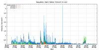
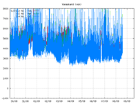
What are harmonics/harmonic tremor?

Harmonic tremor is the name for the very specific vibration caused by the movement of magma and/or the venting of gas underground. While there is a great deal of seismic activity when a volcano is ready to erupt, harmonic tremor is very distinct. On a seismograph, rather than having a peak that rapidly fades, there is a wave pattern. It occurs at frequencies below 20 Hz, below the threshold of human hearing. If the tremors are very strong, poeple and animals can feel the vibrations as a buzzing or humming.

The discovery of harmonic tremors in 1986 made it possible to better predict volcanic eruptions. View a seismograph showing harmonic tremor

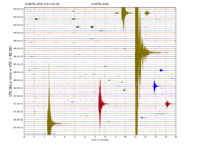
What is a drumplot?

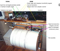
The old-style seismographs used a big roll of paper and the earthquakes were traced on to the paper. Even whem this type of seismograph is generated electronically, they are still called drumplots.

Seismograph parts

How do I read these graphs?

Click the images to view a larger image

Image screenshot from 3D Bulge
3D Bulge Earthquake List

Image screenshot from IMO
DYN Drum Plot

Image screenshot from IMO
DYN Harmonic

Image screenshot from IMO
VON Harmonic

Why can't I see the earthquake on 3dBulge/IMO?

When you see the earthquake appear on a particular page depends on how long it takes for the event to be posted to that page. Plain drumplots such as DYN have only a very small delay, whereas the Icelandic Meteorological Office (IMO) earthquake pages tend to have about a fifteen-minute delay.

The earthquakes have slowed down. Does that mean the eruption is over?

Not so far. The earthquakes have slowed a couple of times since the event began, but they pick back up again within a very short time. Another thing to keep in mind is that once the lava found its way to the surface, some of the pressure that was causing the earthquakes was reduced, thus the earthquakes became slightly less frequent.

Why did the magnitude of the earthquake get changed?

If you're following some of the automatic earthquake lists, they post events the minute they come through. These earthquakes are given a magnitude, depth and location by software, but sometimes the software gets it wrong. A seismologist will review the event shortly thereafter and make adjustments if needed.

There are going to be sunspots, those cause more earthquakes, right?
Why can't we see anything?

There are a number of reasons you might not be able to see anything. The camera may not be working, or the feed may have frozen so the image doesn't update. The Milo site may have become overloaded and crashed. Especially in the area of the eruption, there may be steam or smoke. There also may be dust and of course there's good old-fashioned weather like rain, snow, and fog. Last but not least, it may simply be night-time in Iceland, although that hasn't been as much of an issue lately with the glowing lava.

What's R2D2/The Dalek/The Monolith doing in front of Mila Cam 1?

In early September, a radar station was placed close to Cam 1. If you look at the Cam 1 live feed, you can see it to the lower left. It's intended to analyze the plumes from the volcano, and will be especially useful if the eruption moves under the glacier.

What are those lights?

Lights? What lights? This was an especially common question just before the eruption started, but it still comes up now and again.

Most often, the lights are from vehicles belonging to scientists. They are checking on instruments that have been placed around the eruption, and somtimes moving them. The radar unit located near Mila Cam 1 also has red blinking lights. If one briefly looks at the page, it's relatively easy to mistake those lights for a new spot of lava.

How far away is the camera? 

Approximately 20 kilomters (12 miles)

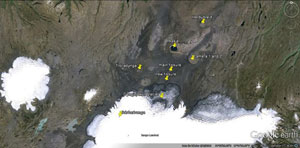
Where is the camera?

Click for a larger image
cam location

What is that big mountain in the frame?

The big mountain that appears in the far right of the camera frame (sometimes it is not visible due to the camera being moved) is Kistufell

Camera is shaking. Are those tremors?

The answer to that depends on how much the camera is shaking. If you've been watching for a while and the camera has been very steady, then it shakes briefly and steadies again, that's likely to be caused by an earthquake. If the camera seems to be shaking a great deal, that's likely due to wind. This is especially noticeable on Mila Cam 2, which is frequently zoomed. The more zoom, the smaller the motions that affect it.

What is the truck/vehicle in cam 1?

This is most likely scientists or other personnel doing maintenance on the instrumentation. If you are watching the camera at the right time during daylight hours, you will occasionally see people as well.

What is the difference between Burre01's live feed and the others?

Burre set up his live feed to help reduce the heavy traffic on the Mila web site, which was causing it to crash fairly regularly. The feed doesn't just contain the cam images, but also has useful graphs of things like earthquake activity. Burre also moderates the live chat on the feed page which keeps annoyances to a minimum, and he checks in frequently.

Many people are now setting up live feeds, but Burre's chat is where you will find the people who helped put this FAQ together.

The cameras are dead.

The Mila cameras may have crashed. Also, make sure that the "live" button on the feed is active.

Can't you change the view on the camera?

Only Mila can change the cams.

Has there been a flyover today?

Since flyovers have a variety of sources, from scientific to tourism, the best thing to do is check the Icelandic news sources. You also might consider joining the Addicted to Bardabunga Facebook Group, as links of interest are posted regularly.

Conduct in Live Chat

This especially applies to Burre's live feed, but good manners are welcome everywhere.

  1. All the people in the chat who answer questions are volunteers. Please be respectful of their time and appreciate their efforts
  2. While there is no such thing as a stupid question, please check this FAQ and see if your question has been answered before asking in chat.
  3. Please don't use the chat as a substitute for checking the news yourself.
  4. You'll have to look elsewhere for Doom porn.

Special note: Over the last few days there have been some complaints posted to the Facebook page about chat, and some have gone to one chat to complain about another.

This is rude. Please don't do it!

If you are not happy with the chat on a livestream, find another. For the most part, these streams are posted by volunteers and fellow enthusiasts, and each has its own rules.

Let's repeat that. For the most part, these streams are posted by volunteers and fellow enthusiasts. They don't get paid to do it and they aren't making money from it. They are under no obligation to change the chat to suit you. People in the chat are not obligated to talk about the things you want to talk about, nor are they under any obligation to answer your questions, especially if the question has already been answered in the FAQ

The reason this FAQ recommends Burre's livestream is because the people who helped create this FAQ can be found there. Burre doesn't get paid for livestream and he doesn't solicit donations. (It is true that people have donated pizza money to him as a thank-you for his efforts, you might consider doing the same for any volunteer). More livestreams are listed on the Facebook page, and more are being made every day, so there is bound to be a chat you like somewhere.
jökulhlaup

A jökulhlaup is a flood caused by a glacier melting rapidly.

Bárðarbunga

Bárðarbunga was named for a Norse settler named Bárður Bjarnason. The name translates to "Bárður's bulge" or "Bárður's bump"

Holuhraun

Holuhraun literally means "lava holes", so, a lava field with lots of holes in it.

Dyngjujökull

Dyngjujökull means Heap Mountain

Trölladyngja

Trölladyngja means "Troll's Heap"

What about Yellowstone?

Yellowstone is an entirely different type of volcano, commonly referred to as a supervolcano. Technically, the term supervolcano simply refers to a volcano that can produce 1,000 km3 (240 cu mi) of ash, lava, rock, dust, etc.

Lately the term has been showing up in the titles of thrilling documentary-type television programs. One thing to always remember: Just because a volcano is capable of a certain size of eruption doesn't mean it always has that large of an eruption. Doom porn may be fun, but it's not necessarily realistic.

Is Yellowstone in Iceland?

Yellowstone is located in the United States, in Wyoming, Idaho and Montana, with the major part of it being in Wyoming.

What about the Pole Shift?

In the 1920's, geologists discovered evidence that the magnetic poles of the planet weren't always in the same location. Some rocks showed the evidence of a magnetic field reversal, or, to put it simply, the magnetic North Pole was in the position of the magnetic South Pole. Over time, enough was learned that scientists have a pretty good idea of drives these geomagnetic reversals.

Fast-forward to the Millenium. Apparently somehow some people got the idea that a geomagnetic reversal or "Pole Shift" was the same as a physical reversal of the North and South Poles, and a whole new genre of Doom porn was born.

Let's set the record straight.

  1. Any event that was so catastrophic that it would cause the physical locations of the North and South Poles to be exchanged in a short period of time would be catastrophic enough to destroy life on earth
  2. It is also true that the poles will shift over time. It will take approximately 250 million years. Here's a great article about it, complete with pictures!
  3. The magnetic poles may be showing signs of a reversal. It's drifted quite a bit over the last hundred years
  4. That being said, there is absolutely no evidence of a geomagnetic rift causing extinctions, explosions, or increased sun activity.
  5. It would of course affect animals that used magnetic fields for migration. It would mess up all compasses made prior to the event. There might be a slight increase in skin cancer in unprotected indivduals. That's about it.

For further understanding of geomagnetic reversal effects, there's an excellent NASA article

Contact Us

Fields marked with a * are required